‘Thorp’ is an Old Norse generic name for a village and therefore
the village may well have originated as a Danish settlement sometime after
the Danes invaded England in the 9th century.
The earliest authentic parish record is in the Domesday Book of 1086 where
it is styled “Thorp”. Domesday records that Thorpe was tenanted
by Ingelrann from Gilo de Picquigney who had also been granted other manors
following the Norman conquest.
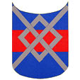 |
Arms
of Richard de Amundeville |
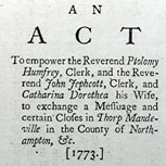
“Mandeville”
is a corruption of the family name Amundeville; Richard Amundeville and his
heirs were lords of the manor during the 13th century. Richard was granted
the right to a weekly market and annual fair in 1281.
The village came within the Poor Law Commissioners’ definition of a
‘closed’ village - having only a few dominant land owners. Therefore
the development of the village was primarily dependent on the lord of the
manor for dwellings, livelihoods and places of worship. For example - a non-conformist
chapel would have been out of the question…
|
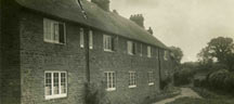
| Dove cottages |
This is evidenced as late
as the early 1900s when Dove Cottages were rebuilt. No front doors were constructed
to the cottages, reportedly because the lord of the manor’s wife did
not want to see village ladies sitting outside their homes.
It was well into the 20th century before many dwellings were released from
the manor and church estates.
The enclosure of Thorpe’s medieval open fields was by agreement and
therefore there is no Parliamentary Act of Enclosure to provide the date and
details. A deed in 1600 mentions enclosures “digged and enclosed by
Richard Westover of Thorpe”. Other 17th century deeds refer to enclosures
but the county historian Bridges refers to open fields circa 1720. It is suggested
that enclosure was a gradual process in the parish.
The population of the parish has not altered greatly in recent centuries.
In 1801 it was 137, in 1901 – 147 and in 1991 - 178.
The village is situated on the important livestock drovers’ road known
as Banbury Lane. It was still in use in the early 19th century, covering 22
miles from the west of Banbury to Northampton. Banbury Lane is the main lane
running through the village but the name was not formally registered by the
local authority until 1996. Similarly Bulls Lane, meeting Banbury Lane opposite
the church, was not formally registered until 1996. Bulls Lane may well relate
to the Bull families who lived in Thorpe during the 16th and 17th centuries.
Townsend Lane, the lane joining Banbury Lane opposite the Three Conies, may
relate to Townsend Proof who lived in the village with his family during the
early 18th century.
|
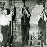
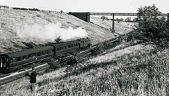
LMS
tank engine 42082, local service (Banbury |
The dismantled railway
line gently scarring the north-west of the parish is a remnant of the Banbury
branch line of the Great Central Railway from Woodford Halse which connected
with the Great Western line at Banbury. It opened in 1900 and closed in 1964.
The line was mainly hidden within cuttings as it crossed the parish. The nearest
station was merely a halt by the Eydon Road turning in Culworth.
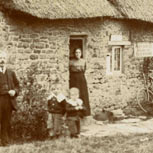
We should remember that for many years the approach to the village was by
muddy tracks. Life would have been hard with livelihoods dependent on agriculture
and the needs of the lord of the manor. Visits to the market towns of Banbury
and Brackley would have been difficult, even for the gentry. Electricity did
not come to the parish until 1949 - half a century after the closure of two
boarding schools in the village.
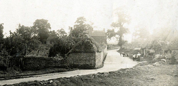
(Main photograph: Looking towards The Three Conies from where The Warren houses currently stand, probably c1900)